
Webcam Pitangueiras (Guarujá) in diretta, previsioni surf e temperatura dell'acqua
Aggiornato 12 ott, 14:00 UTC
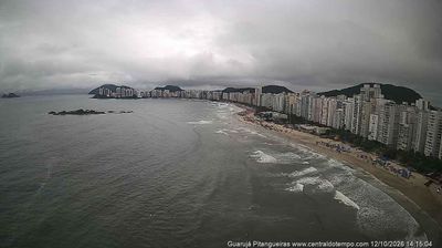
Condizioni attuali
In questo momento a Pitangueiras (Guarujá): 4 nodi da SSW, raffiche a 12, onde di 1.1 m, acqua a 24 °C — buone onde per surfare.
Previsioni a 7 giorni
| dom 11 | lun 12 | mar 13 | mer 14 | |||||||||||||||||||||
|---|---|---|---|---|---|---|---|---|---|---|---|---|---|---|---|---|---|---|---|---|---|---|---|---|
| 21 | 00 | 03 | 06 | 09 | 12 | 15 | 18 | 21 | 00 | 03 | 06 | 09 | 12 | 15 | 18 | 21 | 00 | 03 | 06 | 09 | 12 | 15 | 18 | |
| Vento | 5 | 4 | 6 | 6 | 5 | 4 | 5 | 5 | 4 | 1 | 2 | 3 | 3 | 7 | 6 | 3 | 0 | 1 | 2 | 4 | 5 | 6 | 1 | 2 |
| Raffiche | 8 | 7 | 14 | 12 | 12 | 11 | 13 | 11 | 8 | 6 | 4 | 6 | 9 | 18 | 16 | 6 | 1 | 3 | 5 | 7 | 12 | 15 | 10 | 7 |
| Direzione | ↑ | ↑ | ↑ | ↑ | ↑ | ↑ | ↑ | ↑ | ↑ | ↑ | ↑ | ↑ | ↑ | ↑ | ↑ | ↑ | ↑ | ↑ | ↑ | ↑ | ↑ | ↑ | ↑ | ↑ |
| Onde | 1.1 | 1.1 | 1.1 | 1.1 | 1.1 | 1.1 | 1.1 | 1.1 | 1.1 | 1.1 | 1.1 | 1.1 | 1.0 | 1.0 | 1.0 | 1.0 | 1.1 | 1.1 | 1.0 | 1.0 | 1.0 | 1.0 | 0.9 | 0.9 |
| Temperatura | 21 | 21 | 21 | 21 | 21 | 22 | 22 | 21 | 21 | 21 | 20 | 20 | 24 | 25 | 27 | 25 | 23 | 23 | 23 | 22 | 27 | 26 | 25 | 22 |
| Pioggia (mm) | 4.6 | 2.2 | 1.7 | 0.5 | 0.5 | 1.9 | 1.8 | 0.1 | 0.2 | 0.1 | 0.4 | 0.1 | 2 | 1.8 | ||||||||||
Orari in ora locale · Dati meteo di Open-Meteo.com
🔒 I giorni 4–7 sono Pro — Il piano gratuito mostra i primi 3 giorni di previsioni. Passa a Pro per vedere tutta la settimana.
🔓 Pro — 19 € / anno
Le previsioni complete a 7 giorni su ogni spot, un abbonamento annuale a prezzo fisso.
Passa a ProMaree (prossime 48 h)
Info sullo spot
- Località: Guarujá (São Paulo)
- Acqua: Mare
- Sport: Surf
- Direzioni del vento migliori: NNNENNWNENW
The central beach of Guarujá on the São Paulo coast, a south-facing bay in front of the town's high-rise seafront. It picks up south and south-east swell, mostly from the cold fronts of autumn and winter, and is offshore in a northerly wind. The beach break is usually small and friendly, but a solid southerly swell brings real waves, with the best banks often near the rocks at either end.
Temperatura dell'acqua a Pitangueiras (Guarujá)
Oggi: 24 °C
| Mese | gen | feb | mar | apr | mag | giu | lug | ago | set | ott | nov | dic |
|---|---|---|---|---|---|---|---|---|---|---|---|---|
| °C | 28 | 29 | 28 | 26 | 25 | 23 | 21 | 21 | 22 | 23 | 25 | 27 |
Media mensile della temperatura superficiale del mare, 2023–2025.
Meteo mese per mese a Pitangueiras (Guarujá)
Onde medie più grandi: aprile, agosto e settembre.
| gen | feb | mar | apr | mag | giu | lug | ago | set | ott | nov | dic | |
|---|---|---|---|---|---|---|---|---|---|---|---|---|
| Vento medio (kts) | 5 | 4 | 5 | 5 | 5 | 5 | 5 | 5 | 6 | 7 | 5 | 5 |
| Giorni ≥12 nodi | 4% | 4% | 4% | 0% | 1% | 2% | 4% | 5% | 7% | 12% | 4% | 5% |
| Onde (m) | 1.1 | 1.0 | 1.1 | 1.4 | 1.4 | 1.3 | 1.4 | 1.5 | 1.5 | 1.4 | 1.3 | 1.2 |
| Aria max (°C) | 28 | 29 | 28 | 26 | 25 | 24 | 22 | 22 | 24 | 24 | 26 | 28 |
| Acqua (°C) | 28 | 29 | 28 | 26 | 25 | 23 | 21 | 21 | 22 | 23 | 25 | 27 |
Medie del modello 2023–2025 (Open-Meteo). Vento: media diurna 8–20; un giorno conta se ha almeno 3 ore diurne con 12 nodi o più.
Pitangueiras (Guarujá): domande frequenti
- C'è una webcam a Pitangueiras (Guarujá)?
- Sì. La webcam in diretta di Pitangueiras (Guarujá) è in cima a questa pagina, accanto alle previsioni di vento e onde.
- Qual è la temperatura dell'acqua a Pitangueiras (Guarujá)?
- Oggi l'acqua è a 24 °C. Durante l'anno va da 21 °C ad agosto a 29 °C a febbraio (media 2023–2025).
- Qual è il periodo migliore per fare surf a Pitangueiras (Guarujá)?
- Aprile, agosto e settembre: sono i mesi con le onde medie più grandi, in media 2023–2025.
- Con quale direzione del vento funziona Pitangueiras (Guarujá)?
- Funziona meglio con vento da N, NNE, NNW, NE, NW.


