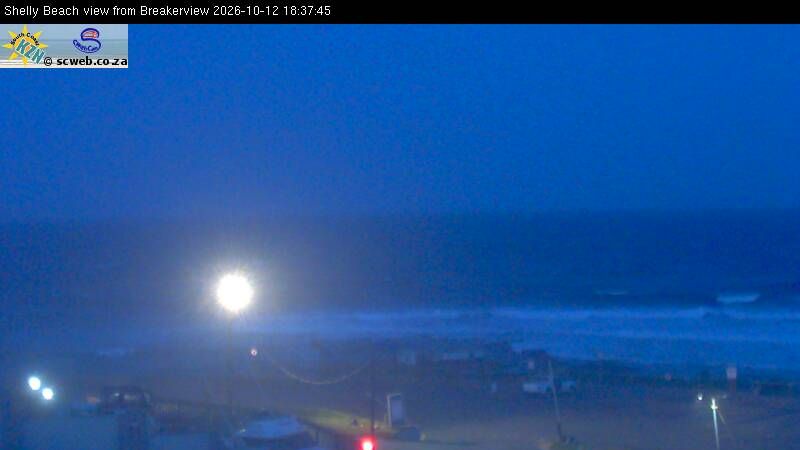
Durban – North Beach surf forecast, webcam & sea temperature
Updated 12 Oct, 14:00 UTC

Current conditions
Right now at Durban – North Beach: 12 kts NNE, gusts 27, 1.9 m waves, water 22 °C — good surfing waves.
7-day forecast
| Mon 12 | Tue 13 | Wed 14 | Thu 15 | |||||||||||||||||||||
|---|---|---|---|---|---|---|---|---|---|---|---|---|---|---|---|---|---|---|---|---|---|---|---|---|
| 03 | 06 | 09 | 12 | 15 | 18 | 21 | 00 | 03 | 06 | 09 | 12 | 15 | 18 | 21 | 00 | 03 | 06 | 09 | 12 | 15 | 18 | 21 | 00 | |
| Wind | 10 | 11 | 12 | 14 | 13 | 10 | 8 | 3 | 11 | 13 | 12 | 15 | 14 | 12 | 10 | 6 | 2 | 0 | 3 | 6 | 5 | 10 | 7 | 6 |
| Gusts | 19 | 21 | 26 | 31 | 29 | 23 | 18 | 12 | 18 | 32 | 27 | 34 | 35 | 26 | 23 | 16 | 8 | 3 | 10 | 18 | 14 | 23 | 16 | 12 |
| Direction | ↑ | ↑ | ↑ | ↑ | ↑ | ↑ | ↑ | ↑ | ↑ | ↑ | ↑ | ↑ | ↑ | ↑ | ↑ | ↑ | ↑ | ↑ | ↑ | ↑ | ↑ | ↑ | ↑ | ↑ |
| Waves | 1.9 | 1.9 | 1.9 | 1.9 | 1.9 | 1.9 | 1.9 | 1.8 | 1.6 | 1.6 | 1.6 | 1.7 | 1.7 | 1.7 | 1.6 | 1.5 | 1.3 | 1.2 | 1.2 | 1.1 | 1.1 | 1.1 | 1.2 | 1.3 |
| Temperature | 22 | 21 | 24 | 27 | 27 | 24 | 23 | 22 | 23 | 23 | 25 | 26 | 25 | 23 | 23 | 23 | 22 | 21 | 25 | 27 | 26 | 25 | 24 | 23 |
| Rain (mm) | ||||||||||||||||||||||||
Times shown in local time · Weather data by Open-Meteo.com
🔒 Days 4–7 are Pro — The free plan shows the first 3 forecast days. Go Pro to see the whole week.
Tides (next 48 h)
Spot info
- Town: Durban
- Water: Sea
- Sports: SurfSUP
- Best wind directions: WSWWWNWNW
The heart of the Durban beachfront, where piers split the sand into a string of consistent beach breaks. Warm Indian Ocean water and swell from south-west to east keep it working much of the year. Early mornings, before the north-easterly sea breeze, are cleanest. The Golden Mile is busy with surfers, lifeguards and walkers, and the vibe is friendly.
Durban – North Beach sea temperature
Today: 22 °C
| Month | Jan | Feb | Mar | Apr | May | Jun | Jul | Aug | Sep | Oct | Nov | Dec |
|---|---|---|---|---|---|---|---|---|---|---|---|---|
| °C | 25 | 25 | 25 | 25 | 24 | 23 | 22 | 21 | 21 | 22 | 23 | 24 |
Monthly mean sea surface temperature, 2023–2025.
Durban – North Beach weather by month
Biggest average waves: August, September and October.
| Jan | Feb | Mar | Apr | May | Jun | Jul | Aug | Sep | Oct | Nov | Dec | |
|---|---|---|---|---|---|---|---|---|---|---|---|---|
| Avg wind (kts) | 10 | 10 | 10 | 9 | 8 | 8 | 9 | 10 | 10 | 11 | 10 | 10 |
| Days ≥12 kts | 49% | 47% | 46% | 40% | 29% | 24% | 35% | 51% | 49% | 55% | 48% | 52% |
| Waves (m) | 1.7 | 1.7 | 1.9 | 1.9 | 1.7 | 1.9 | 1.9 | 2.0 | 2.0 | 2.0 | 1.7 | 1.6 |
| Air high (°C) | 28 | 28 | 27 | 25 | 24 | 23 | 23 | 23 | 23 | 23 | 26 | 27 |
| Water (°C) | 25 | 25 | 25 | 25 | 24 | 23 | 22 | 21 | 21 | 22 | 23 | 24 |
Model averages, 2023–2025 (Open-Meteo). Wind is the daytime mean, 08:00–20:00; a day counts when it has 3 or more daytime hours at 12 knots or above.
Durban – North Beach FAQ
- Is there a beach webcam at Durban – North Beach?
- Yes. The live beach webcam for Durban – North Beach is at the top of this page, next to the wind and wave forecast.
- What is the sea temperature at Durban – North Beach?
- Today the water is 22 °C. Over the year it runs from 21 °C in September to 25 °C in February (2023–2025 average).
- When is the best time to surf at Durban – North Beach?
- August, September and October have the biggest average waves, on the 2023–2025 average.
- What wind direction works at Durban – North Beach?
- It works best in WSW, W, WNW, NW winds.