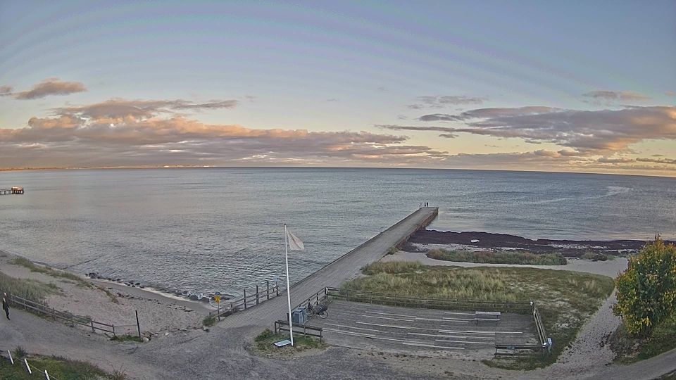
Melnragė surf forecast & sea temperature
Updated 12 Oct, 14:00 UTC

Current conditions
Right now at Melnragė: 12 kts WNW, gusts 18, 0.8 m waves, water 16 °C — small waves, good for beginners.
7-day forecast
| Mon 12 | Tue 13 | Wed 14 | Thu 15 | |||||||||||||||||||||
|---|---|---|---|---|---|---|---|---|---|---|---|---|---|---|---|---|---|---|---|---|---|---|---|---|
| 03 | 06 | 09 | 12 | 15 | 18 | 21 | 00 | 03 | 06 | 09 | 12 | 15 | 18 | 21 | 00 | 03 | 06 | 09 | 12 | 15 | 18 | 21 | 00 | |
| Wind | 12 | 12 | 8 | 7 | 8 | 12 | 12 | 4 | 4 | 8 | 8 | 5 | 5 | 3 | 6 | 5 | 10 | 19 | 20 | 21 | 17 | 19 | 19 | 16 |
| Gusts | 24 | 24 | 16 | 14 | 15 | 19 | 22 | 19 | 17 | 13 | 13 | 12 | 9 | 8 | 10 | 12 | 17 | 29 | 31 | 35 | 26 | 30 | 32 | 29 |
| Direction | ↑ | ↑ | ↑ | ↑ | ↑ | ↑ | ↑ | ↑ | ↑ | ↑ | ↑ | ↑ | ↑ | ↑ | ↑ | ↑ | ↑ | ↑ | ↑ | ↑ | ↑ | ↑ | ↑ | ↑ |
| Waves | 1.1 | 1.2 | 1.1 | 0.9 | 0.8 | 0.7 | 0.8 | 0.8 | 0.8 | 0.7 | 0.8 | 1.0 | 0.9 | 0.7 | 0.6 | 0.5 | 0.5 | 0.8 | 1.2 | 1.5 | 1.5 | 1.7 | 1.8 | 1.8 |
| Temperature | 11 | 11 | 12 | 12 | 13 | 12 | 12 | 11 | 11 | 10 | 9 | 11 | 12 | 12 | 11 | 10 | 12 | 12 | 11 | 12 | 14 | 14 | 13 | 11 |
| Rain (mm) | 2.4 | 13 | 2.8 | 5.3 | 6.1 | 0.1 | 2.7 | 0.1 | 0.6 | 0.4 | 0.1 | 1.6 | ||||||||||||
Times shown in local time · Weather data by Open-Meteo.com
🔒 Days 4–7 are Pro — The free plan shows the first 3 forecast days. Go Pro to see the whole week.
Tides (next 48 h)
Spot info
- Town: Klaipėda
- Water: Sea
- Sports: SurfKitesurf
- Best wind directions: SWWSWWWNWNW
Beach district of Klaipėda, just north of the harbour entrance, and the centre of Lithuania's surf and kite scene. The long harbour mole shelters the southern end, while further north the open Baltic takes the full force of westerly storms. The waves are short-period windswell, at their best as the wind eases. Across the port, the Curonian Spit offers calmer lagoon water for kiting.
No webcam here yet.
Melnragė sea temperature
Today: 16 °C
| Month | Jan | Feb | Mar | Apr | May | Jun | Jul | Aug | Sep | Oct | Nov | Dec |
|---|---|---|---|---|---|---|---|---|---|---|---|---|
| °C | 4 | 3 | 4 | 6 | 11 | 16 | 20 | 21 | 19 | 15 | 10 | 7 |
Monthly mean sea surface temperature, 2023–2025.
Melnragė weather by month
Biggest average waves: January, October and December.
| Jan | Feb | Mar | Apr | May | Jun | Jul | Aug | Sep | Oct | Nov | Dec | |
|---|---|---|---|---|---|---|---|---|---|---|---|---|
| Avg wind (kts) | 11 | 9 | 10 | 9 | 8 | 9 | 8 | 8 | 8 | 11 | 10 | 11 |
| Days ≥12 kts | 61% | 39% | 37% | 38% | 20% | 30% | 25% | 26% | 22% | 54% | 36% | 46% |
| Waves (m) | 1.3 | 1.0 | 0.8 | 0.7 | 0.5 | 0.7 | 0.7 | 0.7 | 0.7 | 1.1 | 1.1 | 1.3 |
| Air high (°C) | 3 | 4 | 7 | 11 | 16 | 19 | 21 | 21 | 20 | 12 | 7 | 5 |
| Water (°C) | 4 | 3 | 4 | 6 | 11 | 16 | 20 | 21 | 19 | 15 | 10 | 7 |
Model averages, 2023–2025 (Open-Meteo). Wind is the daytime mean, 08:00–20:00; a day counts when it has 3 or more daytime hours at 12 knots or above.
Melnragė FAQ
- Is there a beach webcam at Melnragė?
- Not one we can show right now. This page has the 7-day wind and wave forecast for Melnragė.
- What is the sea temperature at Melnragė?
- Today the water is 16 °C. Over the year it runs from 3 °C in February to 21 °C in August (2023–2025 average).
- When is the best time to surf at Melnragė?
- January, October and December have the biggest average waves, on the 2023–2025 average.
- What wind direction works at Melnragė?
- It works best in SW, WSW, W, WNW, NW winds.