Langeoog surf forecast, webcam & sea temperature
Updated 4 Nov, 12:00 UTC
Current conditions
Right now at Langeoog: 12 kts ENE, gusts 20, 0.6 m waves, water 14 °C — small waves, good for beginners.
7-day forecast
| Wed 4 | Thu 5 | Fri 6 | Sat 7 | |||||||||||||||||||||
|---|---|---|---|---|---|---|---|---|---|---|---|---|---|---|---|---|---|---|---|---|---|---|---|---|
| 03 | 06 | 09 | 12 | 15 | 18 | 21 | 00 | 03 | 06 | 09 | 12 | 15 | 18 | 21 | 00 | 03 | 06 | 09 | 12 | 15 | 18 | 21 | 00 | |
| Wind | 11 | 12 | 12 | 12 | 14 | 15 | 14 | 13 | 12 | 12 | 13 | 14 | 15 | 15 | 14 | 13 | 12 | 13 | 14 | 15 | 15 | 16 | 15 | 13 |
| Gusts | 15 | 17 | 16 | 16 | 20 | 22 | 19 | 18 | 16 | 18 | 19 | 20 | 20 | 20 | 19 | 17 | 17 | 20 | 20 | 21 | 21 | 22 | 21 | 19 |
| Direction | ↑ | ↑ | ↑ | ↑ | ↑ | ↑ | ↑ | ↑ | ↑ | ↑ | ↑ | ↑ | ↑ | ↑ | ↑ | ↑ | ↑ | ↑ | ↑ | ↑ | ↑ | ↑ | ↑ | ↑ |
| Waves | 0.7 | 0.7 | 0.6 | 0.6 | 0.7 | 0.7 | 0.7 | 0.7 | 0.6 | 0.6 | 0.6 | 0.7 | 0.7 | 0.7 | 0.7 | 0.7 | 0.6 | 0.7 | 0.7 | 0.7 | 0.8 | 0.8 | 0.8 | 0.7 |
| Temperature | 10 | 9 | 9 | 9 | 10 | 10 | 9 | 8 | 8 | 8 | 8 | 9 | 10 | 10 | 9 | 8 | 7 | 7 | 7 | 8 | 8 | 8 | 7 | 7 |
| Rain (mm) | ||||||||||||||||||||||||
Times shown in local time · Wind, waves and water temperature: ECMWF open data (CC BY 4.0) · Tides: EOT20, DGFI-TUM (CC BY 4.0)
🔒 Days 4–7 are Pro — The free plan shows the first 3 forecast days. Go Pro to see the whole week.
Surf forecast
| Wed 4 | Thu 5 | Fri 6 | ||||||||||||||||||
|---|---|---|---|---|---|---|---|---|---|---|---|---|---|---|---|---|---|---|---|---|
| 13 | 16 | 19 | 22 | 01 | 04 | 07 | 10 | 13 | 16 | 19 | 22 | 01 | 04 | 07 | 10 | 13 | 16 | 19 | 22 | |
| Surf (est.) | 0.3 | 0.3 | 0.3 | 0.3 | 0.2 | 0.2 | 0.2 | 0.2 | 0.2 | 0.2 | 0.3 | 0.4 | 0.4 | 0.4 | 0.4 | 0.4 | 0.4 | 0.4 | 0.4 | 0.4 |
| Primary swell | 0.25s↑ | 0.25s↑ | 0.25s↑ | 0.15s↑ | 0.15s↑ | 0.15s↑ | 0.15s↑ | 0.15s↑ | 0.16s↑ | 0.17s↑ | 0.27s↑ | 0.36s↑ | 0.36s↑ | 0.36s↑ | 0.36s↑ | 0.36s↑ | 0.26s↑ | 0.26s↑ | 0.26s↑ | 0.26s↑ |
| Secondary swell | 0.114s↑ | 0.18s↑ | 0.116s↑ | 0.116s↑ | 0.17s↑ | 0.17s↑ | 0.17s↑ | 0.17s↑ | 0.15s↑ | 0.15s↑ | 0.17s↑ | 0.19s↑ | 0.112s↑ | 0.114s↑ | 0.113s↑ | 0.112s↑ | 0.112s↑ | 0.112s↑ | 0.111s↑ | 0.19s↑ |
| Wind waves | 0.43s↑ | 0.53s↑ | 0.53s↑ | 0.54s↑ | 0.43s↑ | 0.43s↑ | 0.43s↑ | 0.43s↑ | 0.43s↑ | 0.53s↑ | 0.43s↑ | 0.43s↑ | 0.33s↑ | 0.33s↑ | 0.33s↑ | 0.43s↑ | 0.43s↑ | 0.43s↑ | 0.43s↑ | 0.33s↑ |
| Waves | 0.6 | 0.7 | 0.8 | 0.7 | 0.6 | 0.6 | 0.6 | 0.6 | 0.7 | 0.7 | 0.7 | 0.7 | 0.7 | 0.6 | 0.7 | 0.7 | 0.8 | 0.8 | 0.9 | 0.8 |
| Period | 4s | 4s | 4s | 4s | 4s | 3s | 3s | 3s | 3s | 4s | 4s | 4s | 4s | 3s | 3s | 4s | 4s | 4s | 4s | 4s |
| Power | 1 | 1 | 1 | 1 | 1 | 1 | 1 | 1 | 1 | 1 | 1 | 1 | 1 | 1 | 1 | 1 | 1 | 1 | 1 | 1 |
| Groundswell | 0.0 | 0.0 | 0.0 | 0.0 | 0.0 | 0.0 | 0.1 | 0.1 | 0.1 | 0.0 | 0.0 | 0.1 | 0.1 | 0.1 | 0.1 | 0.1 | 0.1 | 0.1 | 0.1 | 0.1 |
Surf height is estimated from the primary swell for a beach facing it; reefs, sandbanks and the tide change it. Power in kW per metre of coast. Groundswell: waves of 12 s and longer. Swell: NOAA WAVEWATCH III · ECMWF
Tides (next 48 h)
Spot info
- Town: Langeoog, East Frisian Islands
- Water: Sea
- Sports: SurfWindsurf
- Best wind directions: SSSESE
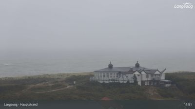
Langeoog is one of the East Frisian Islands off the coast of Lower Saxony, car-free like its neighbours, with ferries from Bensersiel and a short island railway from the harbour to the village. The live beach webcam is aimed at the main beach by the Strandhalle, the beach pavilion at the end of the path from the village, looking out over the dunes to the open North Sea. The beach runs for kilometres along the north side of the island and is wide at low tide, with sand fine enough to make long walks easy. Waves are usually moderate, but a strong north-westerly can push in a short, steep swell that local surfers and windsurfers use; the webcam's own title mentions the surf school at the main beach. As on all the Wadden islands, the tide sets the rules: currents in the sea channels at both ends of the island are strong, and swimming is only advised where lifeguards are on duty in season. The dunes behind the beach include the Melkhörn dune with its lookout. Sea temperature peaks in August and stays cold through winter. Use the Langeoog beach webcam and the surf forecast below to plan the day.
Langeoog FAQ
- Is there a beach webcam at Langeoog?
- Yes. The live beach webcam for Langeoog is at the top of this page, next to the wind and wave forecast.
- What wind direction works at Langeoog?
- It works best in S, SSE, SE winds.